A Brief History of NatWest Bank
And the long-standing importance of Brentford High Street
|
Four hundred years ago a map of the City, Westminster, London Bridge and Middlesex was published by John Speed that shows that the first place of any importance on the main road from London to the west was Great Brentford.
The part of the town that gave rise to this importance is on the Moses Glover map of the 1620s in Syon House. It stretches from the Half Acre to Brentford Bridge and shows a typical medieval settlement with narrow frontages on to the street with long buildings behind.
As well as Great Brentford it was also known as New Brentford or Brainford and owed its prosperity to there having been a bridge built over the river Brent late in the 13th century and the establishment of a weekly market in the early 14th century.
There were alleys between buildings running north and south off the road. The routes of Catherine Wheel, Boars Head and Bradshaw’s Yards are still in existence and would have been the routes to the wharves on the Brent to carry goods and people on to the Thames. Brent and Lion Way parallel with the main road were built in the 20th century to provide access to new developments.
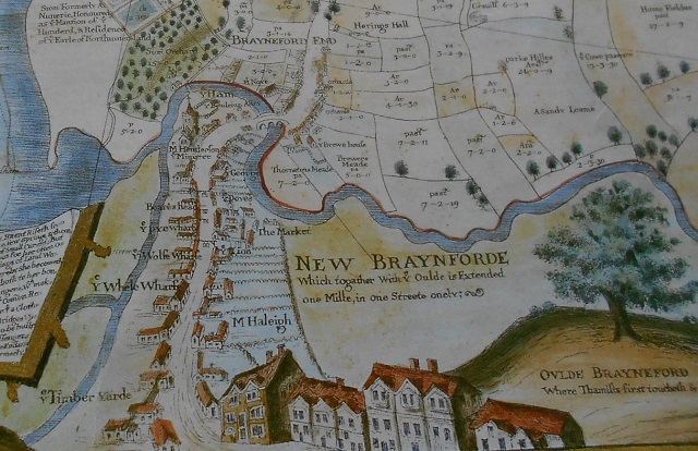
Extract of Moses Glove Map, with Syon and the west at the top
The Tithe map of 1841 shows the town still with the same layout and the site of the bank is a double width building, then a large house with land behind. The census of that year showed it was occupied by Rev Moses Banks, of Independent means, his wife, two companions and three female servants.
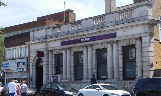
It was still a private house in the 1851 census but by 1874 had become the London and County Bank with the bank on the ground floor and basement and a large living space on the two floors above.
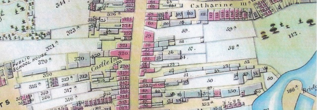
Extract of Tithe map, 1841, with Catherine Wheel Road and the east at the top (see full version at BHS Project)
A description of 100 & 101, High Street and some of the occupants is on the Brentford High Street Project website (www.bhsproject.co.uk) and pictures of the area in books of historic photographs are available at the library or from www.brentfordandchiswicklhs.org.uk .
Chiswick Library Local Studies have notices and reports of meetings about a possible bye pass to avoid the traffic jams along the narrow road before Queen Victoria came to the throne in 1837. This idea was voted down by local traders fearing loss of business. In 1901, though tram lines were laid through the High Street. There was very little space for overtaking and 10 crossovers in 1mile of High Street were laid for trams to pass parked vehicles. There were so many complaints about the delays through Brentford that the Middlesex County Council passed plans for a bye pass but this couldn’t be built until after the First World War.
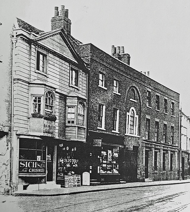
Barleycorn pub and 100-101 High Street, courtest Chiswick Local Studies
By 1911 the census showed that Frederick William Clarke was the manager of the London County and Westminster Bank. He was 59 years old and had been born in Punjab, India. He and his wife and servant lived above the bank in accommodation consisting of 11 rooms. Details of these in 1915 is part of the BHSproject website.
In 1920 it was operating as London County Westminster & Parrs Bank and then rebuilt by Westminster Bank Ltd in 1929. It became Nat West in 1997.
After the Second War most of the High Street was subject to planning blight.
I first arrived to work here in 1958 to work for the Inland Revenue. I didn’t realise at the time but Thanet House, County Parade and around the Market Place were very new buildings. Most of County Parade was taken up by a Woolworths shop, HM Inspector of Taxes Chiswick District was on the top floor of Thanet House (now the Market Building) and one floor lower than the current building) and most of the first floor was taken up by ladies with sewing machines in the first days of Brentford Nylons.
The rest of the High Street was narrow and lined by old shops.
I moved away for several years and was living in Ealing by the 1960s and found that Brentford, as I knew it, seemed to have disappeared.
The building line had been set back to create a bus lane in Old Brentford near Ealing Road but it created much wider pavements to the west in what had been New Brentford. There were flower beds along the whole length from Half Acre to Market Place filled with roses and other plants until the shop keepers complained that passersby couldn’t get to the shops without going all around the beds and they were removed.
At least since WW2 the town has always been changing.
Is it always for the best?
I don’t know but over the years have tried to record the changes and hope that any pictures, documents and archives from here will be offered to the local studies library in Chiswick or Gunnersbury Museum which will be opening soon.
After the meeting I discovered that the two war memorials have been removed to the Chiswick branch of Nat West.
Janet McNamara
June 15, 2018
![]()